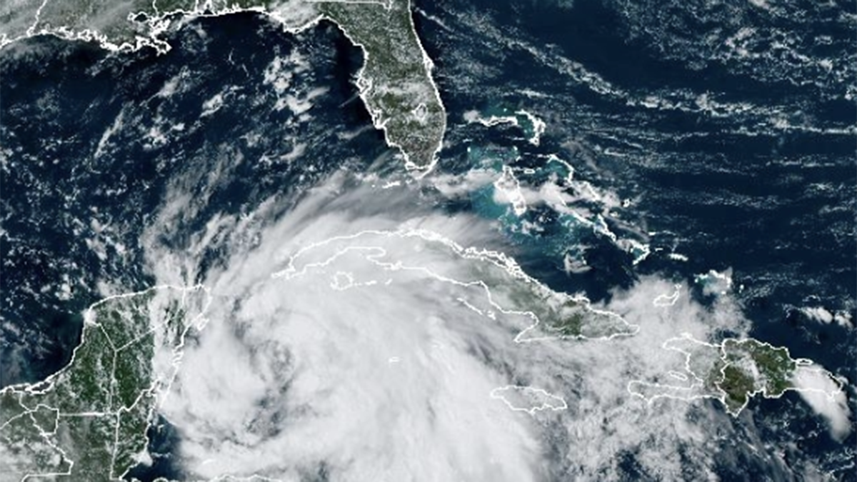
While several days have elapsed without a named storm in the Atlantic, that is expected to change in the week ahead.
As of Sunday afternoon, forecasters at the National Hurricane Center in Miami were giving the area of unsettled weather in the Northwestern Caribbean a 40% chance for development in the next day or two, with an 80% chance for development by the middle of the week.

In this period, it is expected that a tropical depression or tropical storm will form.
The Hurricane season is on. Our meteorologists are ready. Sign up for the NBC 6 Weather newsletter to get the latest forecast in your inbox.
As a result, tropical storm watches or warnings could be issued as soon as Monday for portions of Cuba and Mexico.
The next named system for the 2024 hurricane season will be “Helene.”
The timing of the system’s development, and the movement that positions the storm in the Gulf of Mexico, will have an important impact on how it tracks towards the United States late-week.
Hurricane Season
The NBC 6 First Alert Weather team guides you through hurricane season
Residents from coastal Louisiana to the west coast of Florida are encouraged to monitor the forecast for the next several days. While it is too soon to pinpoint where the system will ultimately go, the Florida panhandle, through the Big Bend area, could be focal point for impact later in the week.
However, exactly where the system tracks will not be the only focus. The size and the intensity of a storm can present far-reaching impacts, away from the storm’s center. This could include locally heavy rainfall, isolated severe storms and a dangerous rip current risk for both sides of the Florida peninsula.
For South Florida, our weather will be determined by the anticipated storm’s position and intensity. This could include breezy conditions, passing downpours, high surf and dangerous marine conditions.
Review your hurricane plan with the free NBC6 hurricane guide found here.


